
News Summary
Tallahassee and much of North Florida are preparing for a significant weather system expected to bring severe thunderstorms and possibly tornadoes this weekend. Residents have been advised to stay alert as a slight risk of severe weather has been forecasted, with the most severe conditions likely to occur on Monday afternoon or evening. Emergency preparedness is essential, with recommendations to check weather radios, stay indoors during storms, and prepare for potential tornadoes.
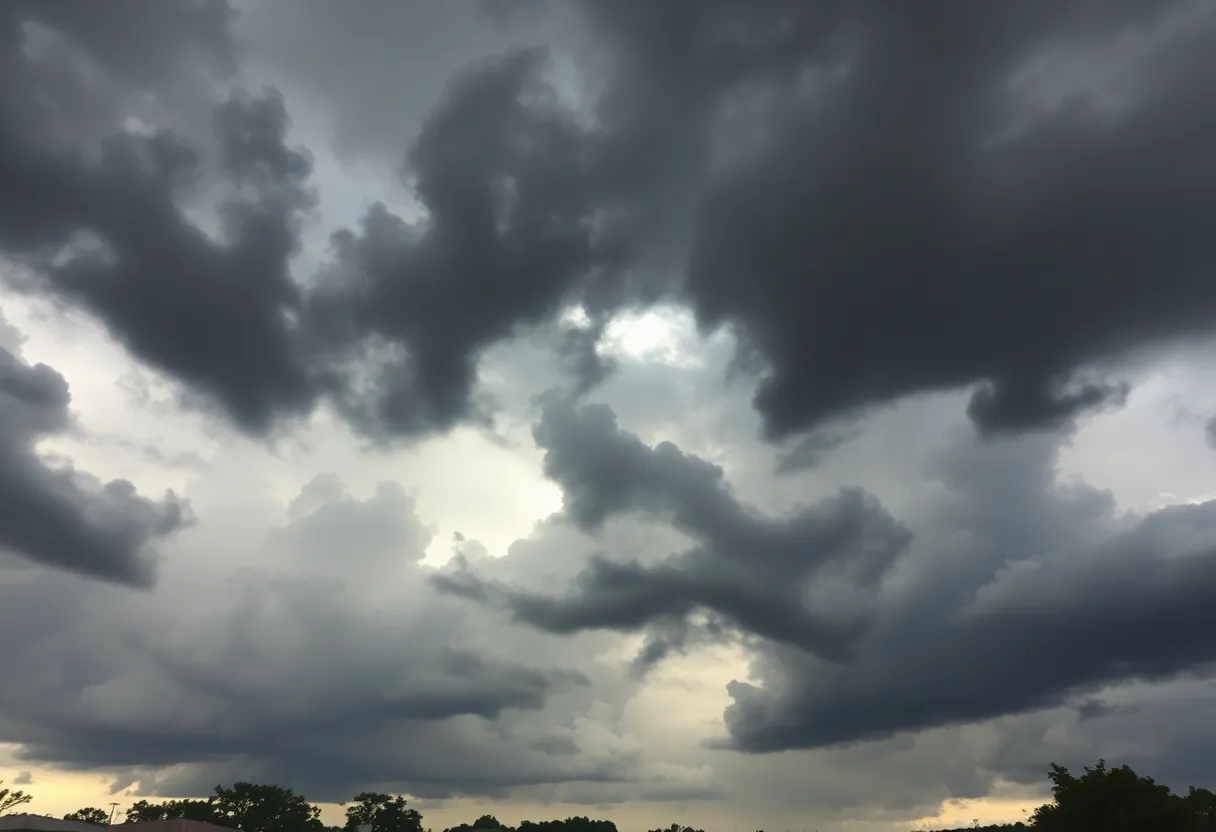
Tallahassee Braces for Severe Weather This Weekend!
Residents of Tallahassee and much of North Florida, listen up! A significant weather system is gearing up to sweep through the area, and it’s bringing the potential for some pretty severe thunderstorms and possibly even tornadoes. As Monday approaches, a slight risk (level 2 out of 5, for those keeping score) of severe weather has been forecasted for our region, with chances of severe conditions sitting between 15% to 29%. So, what should you be aware of?
The Storms Are Coming!
The Storm Prediction Center has put out warnings for a large portion of the eastern United States, ranging all the way from New Orleans to New York. As a cold front makes its way through the Tallahassee area on Monday, we can expect to see scattered showers and thunderstorms start to brew. While the most severe conditions are likely to focus their wrath on the northwest—especially Alabama and Mississippi—Tallahassee residents should still prepare for a bumpy ride.
What Type of Storms Can We Expect?
Forecasters are letting us know that the storm system could whip up damaging straight-line winds and potentially a tornado or two as it continues into Florida and southwest Georgia. The prime time for severe weather in Tallahassee seems to be on Monday afternoon or evening, but let’s not forget the chance of strong, long-track tornadoes and damaging wind gusts that could begin overnight on Saturday, rolling into Sunday morning.
Storms might creep into our area as early as Midnight to 1 a.m. on Sunday, with the main action likely occurring between 4 a.m. and 10 a.m. So if you’re planning on catching some Z’s this weekend, you might want to stay alert!
Stay Prepared!
People, this is your friendly reminder to check that your weather radios are operational and to make sure your cell phones are set to receive emergency alerts. It’s super important, especially as you drift off to sleep. Taking a few moments to plan your options for getting to safe spaces, like interior rooms on the lowest floors of your home, can be a lifesaver if a tornado decides to make an appearance.
Keep your shoes handy, just in case you find yourself needing to make a hurried exit!
What’s on the Radar?
Weather experts are expecting a mixed bag of storms to form ahead of that cold front, which means we could be seeing everything from strong tornadoes to wind gusts that could howl over 70 mph and even large hail. With the timing of these storms, the threat is even more concerning after dark when most folks are sleeping.
Community Response
The Leon County administration is closely watching the storm system, and if things start looking worse, the Emergency Operations Center might be triggered into motion. Residents can expect numerous storms, particularly with an enhanced risk (level 3 of 5) for parts of the Panhandle and Big Bend region, which includes western Leon County.
Already, damages from this storm system have sadly led to at least 30 fatalities across various states, with tornado watches being issued for much of the Big Bend and southern Georgia until 10 a.m. Heavy rain and wind gusts topping 66 mph have caused significant damage in some areas, leading to multiple severe weather warnings.
Stay Safe Out There!
As the storm approaches, it’s wise to remember to move to sturdy buildings if you live in mobile homes and stay indoors for at least 30 minutes after the last clap of thunder. Power outages have also begun to crop up, with around 2,000 outages logged in North Florida, mainly in the Tallahassee area. Tornado watches are being carefully monitored across various counties in Florida, given the high possibility of tornado activity.
In conclusion, make sure to stay tuned into your weather alerts and always have a backup plan for safety measures. Grab that emergency kit, recharge your devices, and let’s weather this storm together! Here’s hoping everyone stays safe and sound!
Deeper Dive: News & Info About This Topic
HERE Resources
Lincoln Trojans Rise to the Top of Leon County Baseball Rankings
Brightline Expands Commuter Rail Service in South Florida
Tallahassee’s Pizza Showdown: The Final Four is Here!
Wildfires Force Evacuations in North and South Carolina
Massive Brush Fire Causes Havoc in South Miami-Dade
Tallahassee Welcomes New Dining Options Near Chiles High School
Tallahassee Faces Multiple Police Incidents, Safety Concerns Rise
University of Miami Baseball Stunned by Florida State’s Dominance
Florida State University Dominates Miami Baseball
Florida Wildfire Disrupts Access to the Keys for the Third Day
Additional Resources
- Tallahassee.com: Severe Weather Possible Monday
- Weather.com: Tallahassee Weather
- Tallahassee.com: Weather Warning for Severe Storms
- Fox Weather: New Orleans Severe Storms
- Wikipedia: Tornado